Where We Go
Mark where you've been, choose where you'll go.
Where We Go is an Android globe for logging your travels. Every country, region or city can be marked as visited or to visit. Visited countries fill with their flag, and little by little the globe becomes a portrait of every place you've been. It works offline: the map of the whole world lives inside the app.
The idea
Travellers know it: after a few years the places you've seen start to blur. Did I go to Croatia two or three times? Did we stay in Naples or just pass through? The apps meant to keep count often stop at countries, require an account, show ads or need the internet exactly when you're travelling.
Where We Go starts from a simple question: what if the memory of your travels took the shape of a globe? A globe to spin with your finger, where at a glance you see how much of the world you've already seen and how much is left. With a level of detail that goes down to the smallest town.
From the globe to the cities
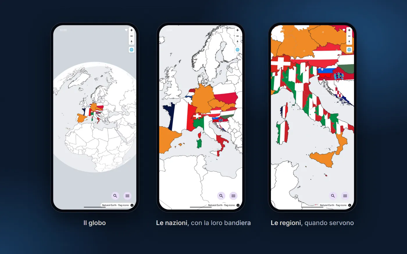
The map opens on a 3D globe. Zooming in, countries appear, each one filled with its own flag if you've been there, in orange if it's on your wish list. Regions light up country by country, only where needed: so Italy can have twenty regions marked one by one, while a country seen in passing stays a single patch of colour.
Closer still, cities appear as dots: red for those to discover, orange for those planned, green for those already visited.
The video below shows the full journey, from the whole globe down to a region's card.
One tap to look, one to mark
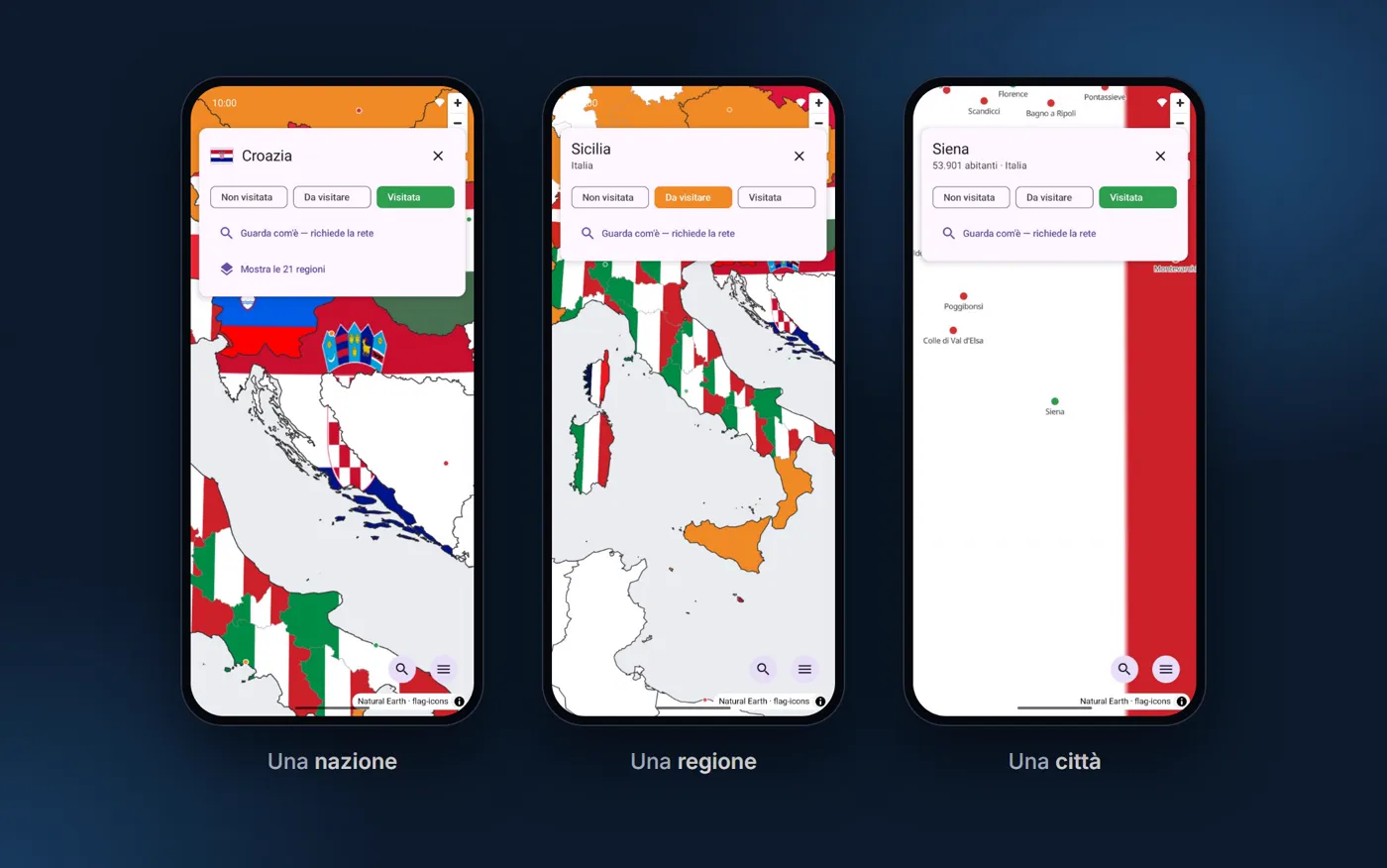
Tapping a place only selects it: a card opens with the name, the country, the population, and three buttons — Not visited, To visit, Visited. No tap changes anything by mistake.
The card sits at the top, not the bottom: your finger and the place you just tapped are in the lower part of the screen, and a card rising from the bottom would cover them.
From a country's card you can switch on its regions. The rules are designed so the map always tells the truth: if you've seen at least one region, the country counts as visited; but switching on a country's regions doesn't mark them all as visited, because "I've been to Italy" doesn't mean "I've been to all twenty regions".
Find any place
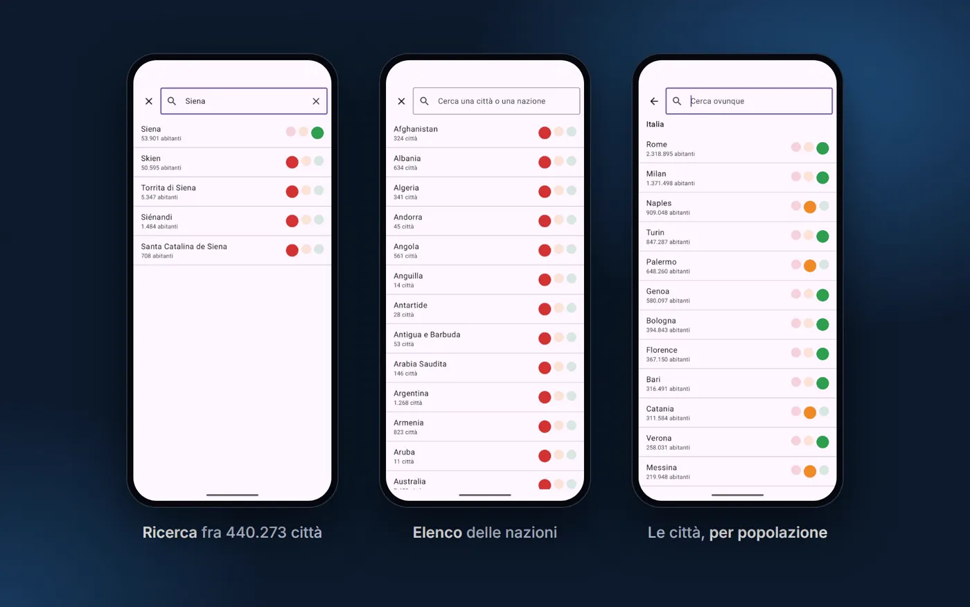
- Search across 440,273 cities and 249 countries, even without accents: type Kamarhati and you find Kāmārhāti. Tapping a result flies the map there.
- List of countries, and inside each country its cities sorted by population. It's not a detail: Mexico has more than one hundred thousand cities, and in alphabetical order finding the right one would be impossible. Each row has the three dots to mark it without even opening the map.
How much of the world you've seen
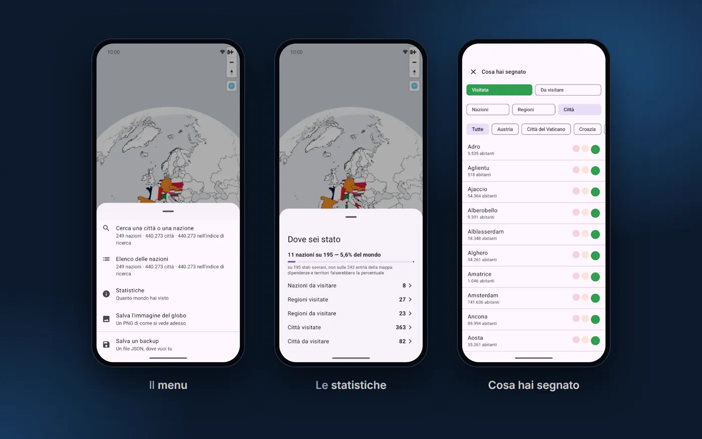
The stats count countries, regions and cities visited or to visit, and the percentage of the world you've seen. The percentage is calculated on the 195 sovereign states, not on the 249 territories on the map: counting islands and dependencies would inflate the number.
Each entry opens the list of what you've marked, filterable by status, type and country. From the menu you can save a backup to a file, restore it on another phone, or export an image of the globe to share.
See what it looks like
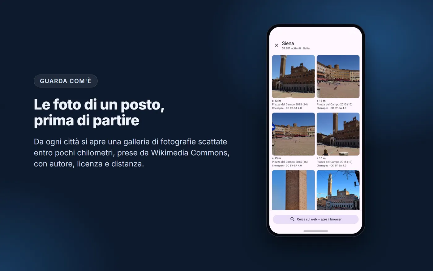
Every city opens a gallery of photos taken nearby, from Wikimedia Commons, with the distance, author and licence of each. It's the only part of the app that uses the internet, and only when you open it.
Attention to detail
Flags in the right place. Filling a country with its flag seems easy, and it isn't: flags are wide rectangles, while most countries are taller than they are wide. Cropping them like a photo, 71% of countries would show less than three quarters of their flag, and of Ireland you'd only see the white band. After comparing five solutions, each flag is fitted whole to the country's shape, with a few exceptions justified one by one (Russia, for example, ignores the Arctic islands).
Flags visible at any distance. Painting hundreds of flags costs memory: with a naive approach, at full globe it would be almost 800 MB. Each flag is drawn at the size it actually takes on screen, and the worst case drops to 21 MB.
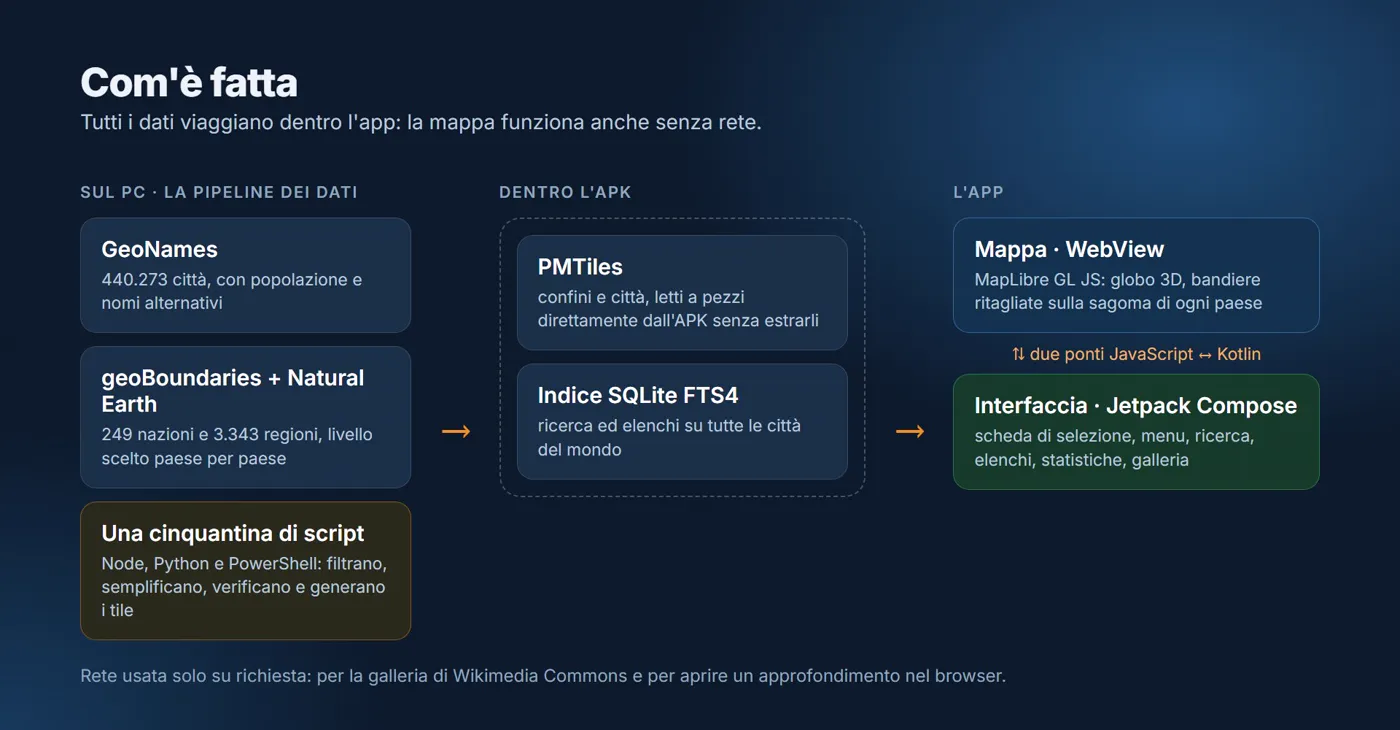
Real data, respected. Borders and regions come from geoBoundaries and Natural Earth, cities from GeoNames, chosen country by country. Many of these sources ask whoever uses them to republish the data derived from them: that's why the app's data is also published separately, one file per country, each with its source and licence.
No account, no ads. Everything you mark stays on your phone.
In two languages. The app is in English and switches to Italian when the phone is set to Italian.
The project at a glance
| What it is | An offline globe to mark countries, regions and cities as visited or to visit |
|---|---|
| For whom | Travellers who want to keep track of the places they've seen, and those still to see |
| Platform | Android |
| Language | English and Italian |
| Cost | Free and open source |
| The numbers | 249 countries, 3,343 regions, 440,273 cities, 255 flags |
| Built with | Kotlin and Jetpack Compose (interface), MapLibre GL JS (map), PMTiles and SQLite (data), Node.js and Python (data processing) |
| Author | Gabriele Fiorucci: concept, design, development of the app and the data processing |
Download it or browse the code: github.com/GabrieleFiorucci03/Where-We-Go ↗
Future developments
- Release on Google Play and the Apple App Store
- Regional coats of arms, alongside the national flags
- Stats by continent and a year-by-year travel timeline